

Overview:
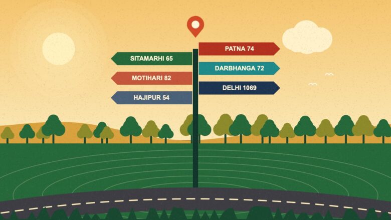
Muzaffarpur sits at the heart of north Bihar, and many trips start or end there. This distance chart lists the road distance from the city to 16 key places, from Hajipur at about 54 km to Delhi at about 1,069 km. It shows example travel times, explains why distance sources disagree, and gives simple rules to plan a trip. It also links to our detailed guides for Patna, Darbhanga, Sitamarhi, Motihari, Hajipur, Samastipur, Begusarai, Siliguri and Varanasi, so you can jump to the route that matters to you, and plan every trip with a clear buffer.
This guide explains Muzaffarpur distance chart in simple words. Also, How far is Muzaffarpur from your city? People ask this every day. In addition, they search for one route at a time. That wastes time. So we built one page with all the main distances.
Use the table below to find your route. Moreover, Then click the guide for that route. Also, read the notes on why numbers differ. Plan with a buffer, and your trip will go smoothly.
54 km
Hajipur, the nearest big town in this chart
74 km
Patna, the state capital
About 1,069 km
Delhi, the farthest place in this chart
16
places in the chart
Muzaffarpur Distance Chart
All distances are road distances from Muzaffarpur. We took them from one travel site, Yatra, so that the numbers use the same method. Sources can differ, and we explain why later.
| Place | Road distance | Detailed guide |
|---|---|---|
| Hajipur | About 54 km | Muzaffarpur to Hajipur |
| Samastipur | About 56 km | Muzaffarpur to Samastipur |
| Sitamarhi | About 65 km | Muzaffarpur to Sitamarhi |
| Darbhanga | About 72 km | Muzaffarpur to Darbhanga |
| Patna | About 74 km | Patna to Muzaffarpur |
| Motihari | About 82 km | Muzaffarpur to Motihari |
| Bettiah | About 128 km | — |
| Raxaul | About 133 km | — |
| Gopalganj | About 137 km | Sources disagree; see notes |
| Gaya | About 169 km | — |
| Kathmandu (Nepal) | About 273 km by road | — |
| Siliguri | About 383 km | Muzaffarpur to Siliguri |
| Ranchi | About 396 km | — |
| Lucknow | About 529 km | — |
| Kolkata | About 652 km | — |
| Delhi | About 1,069 km | Delhi to Muzaffarpur |
We also have full guides for Varanasi and Begusarai. Furthermore, Open them for road, rail and bus details.
From Hajipur at 54 km to Delhi at 1,069 km, one page covers it all.
Muzaffarpur distance chart
Muzaffarpur distance chart: Why Distances Differ Between Websites
You may see different numbers on other sites. That is normal. Several reasons cause it.
- Route choice: A road through one bridge can be longer than a road through another.
- Start point: A city centre, a bus stand and a railway station are not the same spot.
- Direction: The route from A to B can differ from B to A by a few km.
- Method: Some sites use road routes. Others use a straight line.
- Update date: New roads and bypasses change the numbers.
For example, one site lists the Gopalganj road distance at 137 km. Another lists about 94 km. Since the two figures are so far apart, we advise you to check your own route on a map app before you travel.
Why We Left Out Gorakhpur
Gorakhpur is a popular search, with about 2,400 searches a month. But the source we used lists 1,278 km for it, which looks far too high for a route between two cities in the same broad region. Because listings disagree, we left it out until we can verify it. We would rather show no number than a wrong one.
Muzaffarpur distance chart: Travel Time Examples
Distance is only half the story. Additionally, Speed matters too. The same travel site lists driving times for some routes. Besides, we worked out the average speed for each.
| Route | Distance | Listed drive time | Average speed |
|---|---|---|---|
| Patna | About 74 km | 1 h 24 min | About 53 km/h |
| Darbhanga | About 72 km | 1 h 33 min | About 46 km/h |
| Motihari | About 82 km | 1 h 41 min | About 49 km/h |
| Sitamarhi | About 65 km | 1 h 49 min | About 36 km/h |
So the listed speeds range from about 36 to 53 km/h. That is a good guide for short trips in this region. Add extra time for fog, rain, festivals and market days.
Muzaffarpur distance chart: A Simple Rule to Plan Your Trip
Use this rule of thumb for short routes. In fact, Divide the distance by 40 to get a safe time in hours. For example, 80 km divided by 40 gives two hours. On a good day, you may arrive sooner. But you will not be late.
For long routes, add time for meals, fuel and rest. Of course, Do not plan more than about eight to nine hours of driving in a day.
Muzaffarpur distance chart: Nearby Towns: The Short Trips
Six places lie within about 85 km of the city. Hajipur, Samastipur, Sitamarhi, Darbhanga, Patna and Motihari are all easy day trips. In particular, many people go for work, study, health care or family visits.
Trains and buses serve most of these routes. Read our Bairiya bus stand guide for bus links. Also, For rail, read our Patna to Muzaffarpur train guide and our station guide.
Before you go, check the local news for road works. Bridges and bypasses change the route often. Our news section covers big projects, such as new road over bridges and bypass plans. In addition, a quick check can save an hour on the road. Also, ask locals or drivers for advice, since they know the road better than any app.
Muzaffarpur distance chart: The Mid-Range Trips
Places like Bettiah, Raxaul, Gopalganj and Gaya lie between about 128 km and 169 km away. These trips are half-day journeys. Moreover, start early. Check the road status. Also, keep fuel and water ready.
Raxaul sits on the border with Nepal. Furthermore, many travellers use it as a gateway. Carry valid ID, and follow the border rules if you plan to cross. Rules change, so check the official notice.
Muzaffarpur distance chart: The Long-Distance Trips
Siliguri, Ranchi, Lucknow, Kolkata and Delhi are long trips. Additionally, most people use trains or flights for these. Read our Delhi to Muzaffarpur guide for a full example. Besides, For long road trips, plan overnight stops and share the driving.
Muzaffarpur distance chart: How to Work Out Fuel Cost
You can estimate fuel cost with one simple formula. Divide the distance by your vehicle’s mileage. In fact, Then multiply the litres by the current fuel price. For example, a 74 km trip in a car that gives 15 km per litre needs about five litres. Check the price on the day, since it changes. Also, add a little extra for traffic, idling and detours.
For a round trip, double the distance. Then add tolls, parking and food. In general, share the cost with co-riders to save money.
Muzaffarpur distance chart: Simple Safety Rules for Any Route
Good habits matter on every trip. Do not drive when you are tired. Avoid night driving in dense fog. Of course, keep your papers ready. Carry water, a torch and a charged phone. Also, tell someone your route and your expected arrival. In particular, In an emergency, dial 112.
Muzaffarpur distance chart: How to Check Distance on Your Own
You can also check a route yourself. Use these steps.
- First, open a map app on your phone.
- Next, enter your start point and Muzaffarpur.
- Then, pick the road route, not the flight route.
- Also, compare two or three route options.
- Finally, note the distance and the time, and add a buffer.
Do this for the day you plan to travel. Also, Live traffic can change the time.
Muzaffarpur distance chart: Distance and Weather
The weather changes travel time in Bihar. Fog slows roads and trains in winter. In addition, Heavy rain floods low roads in the monsoon. Heat makes long drives tiring in summer. So check the forecast for the day. Moreover, read our Muzaffarpur weather guide for the seasons.
Rail, Road or Air?
Choose the mode by distance. For trips under 100 km, buses and cars work well. Furthermore, For 100 to 500 km, trains are comfortable and steady. For more than 500 km, trains or flights save time. Additionally, Muzaffarpur has no large commercial airport yet. So fliers land at Patna or Darbhanga. Read our Muzaffarpur airport update for the current position. Facts about Muzaffarpur distance chart can change, so confirm them on official pages.
Key Takeaways
- The nearest big town in this chart is Hajipur, about 54 km away.
- Patna is about 74 km away, and Delhi is about 1,069 km away.
- Listed drive times imply average speeds of about 36 to 53 km/h.
- Distances differ by source, so check your own route on a map app.
- We left out Gorakhpur because listings disagree.
- Add a time buffer for fog, rain and market days.
Did You Know?
Why do speeds look so low on Bihar roads?
Roads pass through towns, markets and river bridges. Speed limits, traffic and level crossings slow the trip. The listed drive times imply average speeds of only about 36 to 53 km/h on short routes in this region. That is why a rule of 40 km/h is safe for planning.
Conclusion
This distance chart puts the main routes from Muzaffarpur in one place. Besides, short trips to Hajipur, Samastipur, Sitamarhi, Darbhanga, Patna and Motihari fall under 85 km. Bigger trips reach Delhi at about 1,069 km. In fact, use the table to plan, and use the detailed guides for each route. Add time for fog, rain and heavy traffic. Check your own route on a map before you leave. In general, Bookmark this page, and share it with friends who travel in north Bihar.
FAQs
What is the nearest big town to Muzaffarpur?
In this chart, Hajipur is the nearest, at about 54 km by road. Samastipur is next at about 56 km, and Sitamarhi follows at about 65 km. Of course, Darbhanga is about 72 km away, and Patna is about 74 km. Motihari is about 82 km. In particular, All of them make easy day trips.
How far is Muzaffarpur from Patna?
The road distance is about 74 km. The drive takes roughly one hour and 24 minutes in normal traffic. Also, Rail distance listings vary between about 72 km and 88 km. Buses, trains and taxis run between the two cities all day. In addition, Traffic near the river bridge can add time.
How far is Muzaffarpur from Delhi?
The road distance is about 1,069 km on one travel site, and another estimate is near 1,015 km. By rail, the distance is about 1,057 km on the Sapt Kranti Express route. Moreover, trains take about 20 hours. Buses take about 16 to 18 hours in listings.
Why do distance websites show different numbers?
Sites may use different routes, start points or update dates. Furthermore, some measure by road, and others by a straight line. New roads and bridges also change the numbers over time. For example, two sites list very different figures for Gopalganj. So always check your own route on a map before you go.
How do I estimate travel time on a short route?
Divide the distance in km by 40 to get a safe time in hours. For example, 80 km gives about two hours. Listed drive times on short routes imply average speeds of about 36 to 53 km/h. Additionally, add extra time for fog, rain, festivals and market days.
